Grey Glacier Day Hike- Hiking to Grey Glacier in Torres del Paine National Park
Purchases made through links earn us a small commission, at no extra cost to you.
Torres del Paine National Park is known for its impressive glaciers and beautiful lakes, and one of the best ways to experience both is by hiking to Grey Glacier (Glaciar Grey) at the end of Lago Grey.
As the biggest and most spectacular glacier in Torres del Paine, Grey Glacier is not to be missed. Its sprawling ice sheet, glistening blue hue, and floating icebergs are a picturesque reward for completing the long day hike to Grey Glacier.
About the Grey Glacier Hike in Torres del Paine National Park
The Grey Glacier trail forms the western arm of Torres del Paine’s famous W Trek. The trail can be done as a day hike, albeit an ambitious one, if you don’t want to do the full W or stay overnight at a refugio.
To do the day trip to Glaciar Grey, you need to take a ferry to the trailhead. Having to adhere to its schedule creates some pressure to complete the hike by a certain time, but the good news is that there’s a wonderful view of Grey Glacier about halfway into the hike if you’re running short on time.
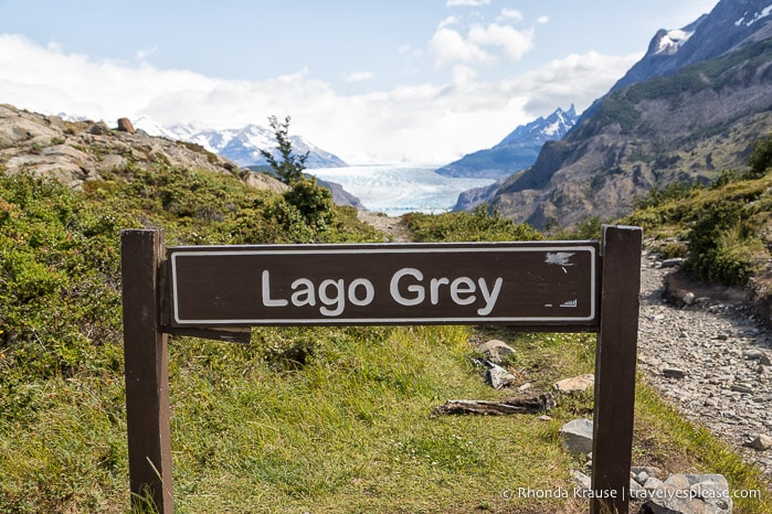
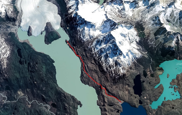
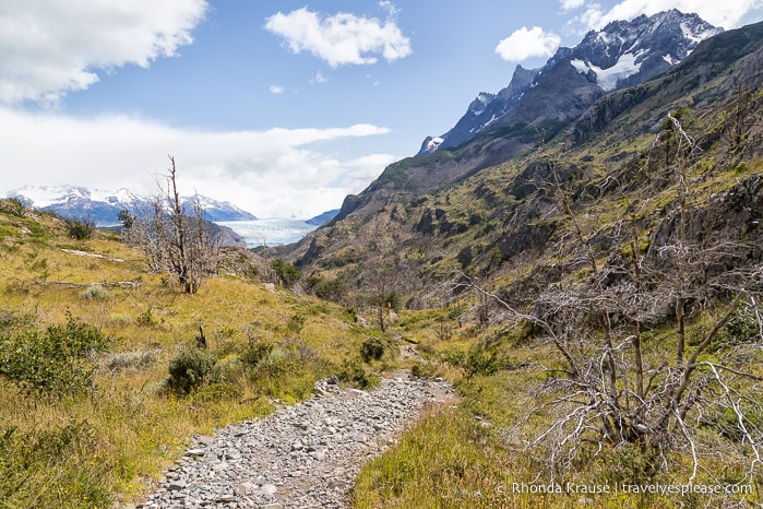
The Grey Glacier hike ascends through a valley then roughly follows along the shoreline of Lago Grey before eventually arriving at a viewpoint near the base of Grey Glacier.
The Grey Glacier day hike is approximately 23 km round trip and takes about 7- 8 hours to complete. It’s rated hard (with some moderate sections) and has an elevation gain of 573 m/1880 ft.
The Grey Glacier Day Hike- Our Experience Hiking to Grey Glacier
The Grey Glacier hike was the third segment we completed in our attempt to hike much of the W Trek as day trips.
Our day hike to Grey Glacier began with a ferry trip across Lago Pehoe from Cafeteria Pudeto to the Paine Grande refugio, where the trailhead is.
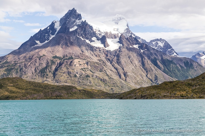
During the 30 minute boat trip we enjoyed wonderful views of the surrounding mountains, including Cerro Paine Grande and the distinctive Cuernos del Paine (Paine Horns).
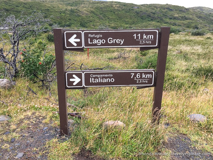
After disembarking the ferry at Paine Grande, we set out on the trail heading east towards the Paine Grande ranger station. We were expecting to have to show our park pass, but no one was at the ranger booth to check it.
Just past the ranger station we turned left where the trail splits, heading away from Lago Pehoe and towards a small valley.
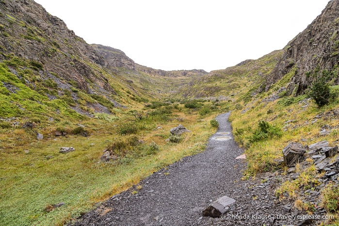
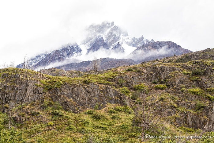
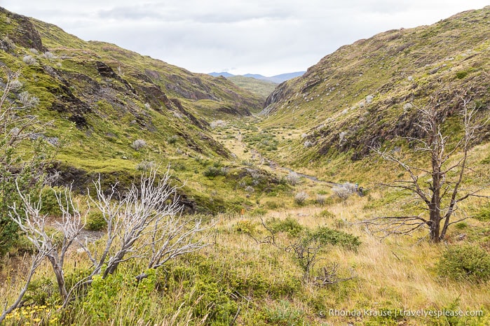
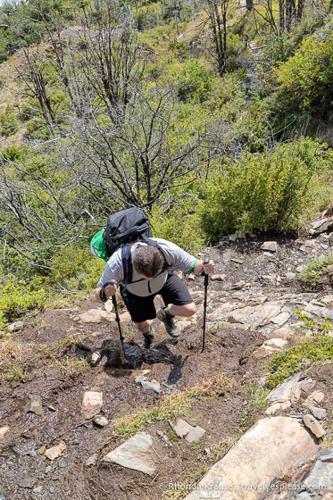
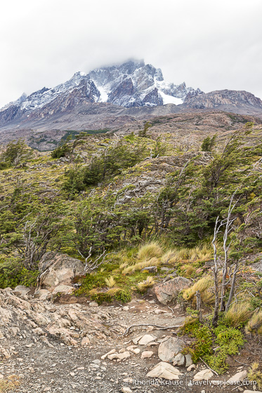
The trail gradually gained elevation as it made its way through the rocky, grass-covered valley. Near the end of the valley the trail got much steeper, revealing views of some surrounding mountains and providing a great vantage point for admiring where we had just hiked.
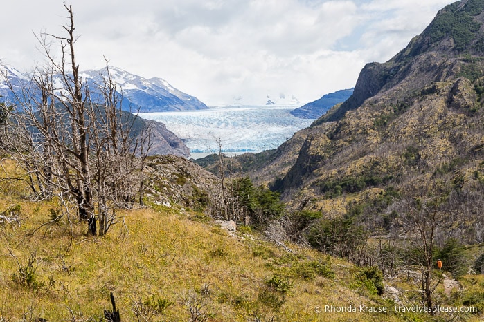
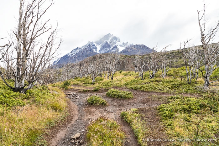
After a short break to take off our rain gear, we continued our ascent. The trail was framed by lifeless trees, short shrubs, and small hills- scenery that reminded me of parts of our hike to the French Valley the day before.
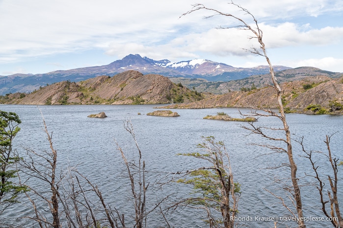
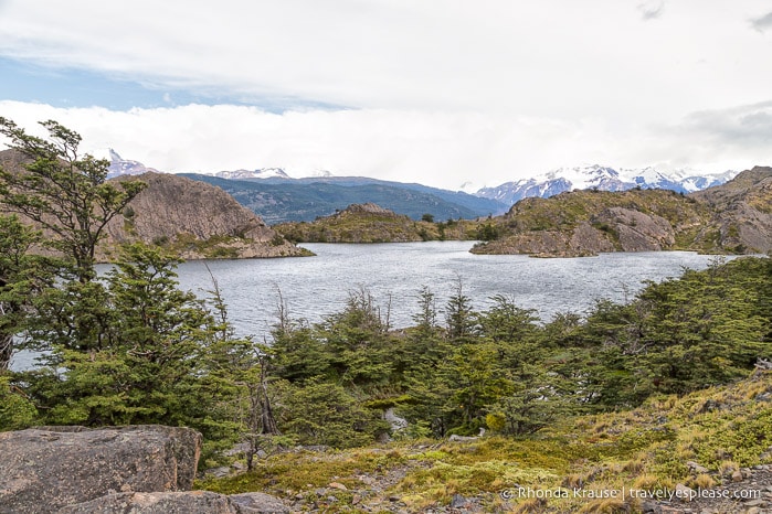
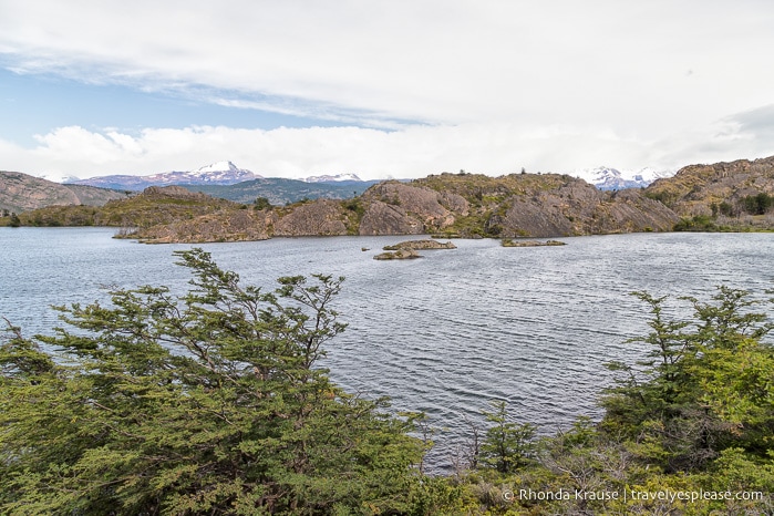
Once the trail turned and headed west, I knew we were getting closer to the lake. To my surprise, it wasn’t Lago Grey that was waiting for us at the top of the hill, but rather Laguna Los Patos, a small lake that sits between Lago Grey and the hiking trail.
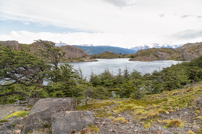
This was by no means a disappointment, since Laguna Los Patos was quite pretty. There were windswept conifer trees along the shore, several small rocky islands, and snowcapped mountains in distance.
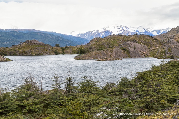
Leaving the viewpoint, the trail headed north along Laguna Los Patos, keeping near the shoreline almost the entire time.
At the end of the lake the trail cut across some open land that’s less sheltered from Patagonia’s intense wind. Thankfully, the wind wasn’t as insane as what we experienced on our first day in the park!
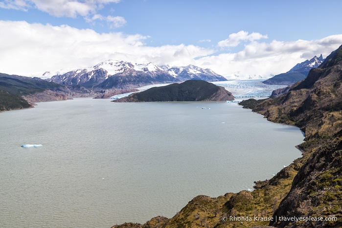
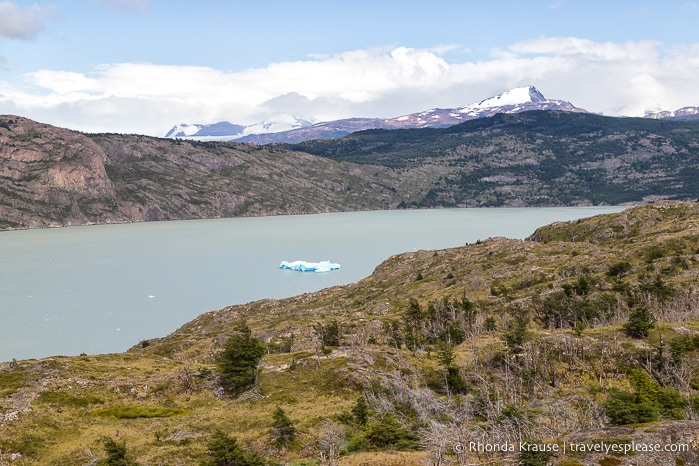
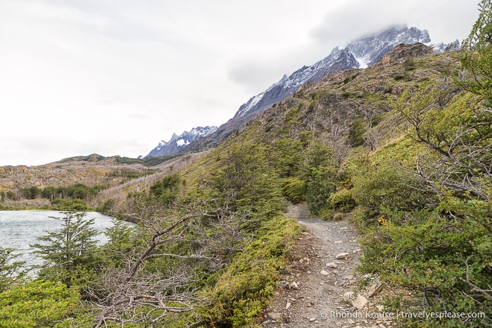
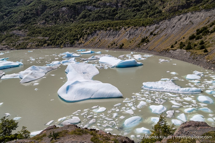
During this section of the hike we got to enjoy some elevated views of Lago Grey. Even though the trail doesn’t get close to the shore here, we still could see some icebergs floating in the water after breaking off from Grey Glacier.
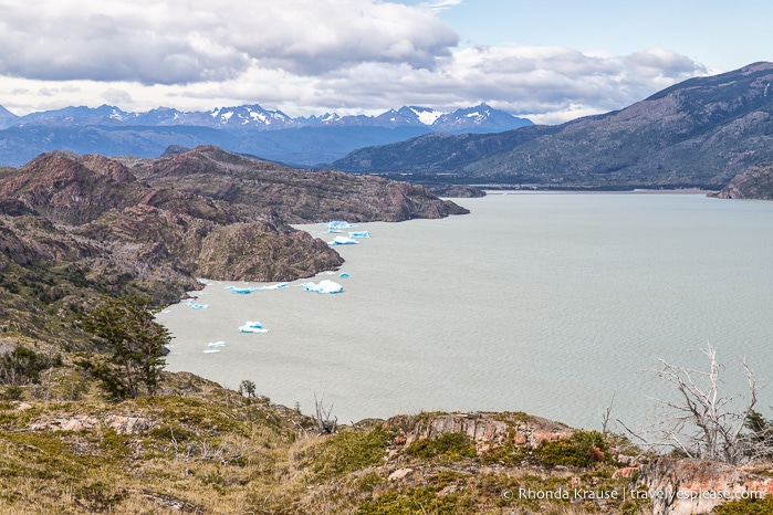
Up to this point, the trail from Laguna Los Patos had several minor elevation changes, but now it began to climb up towards Mirador Lago Grey.
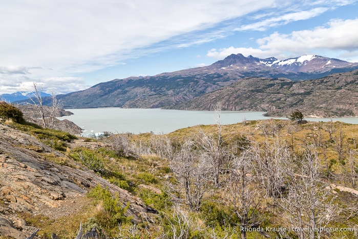
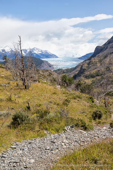
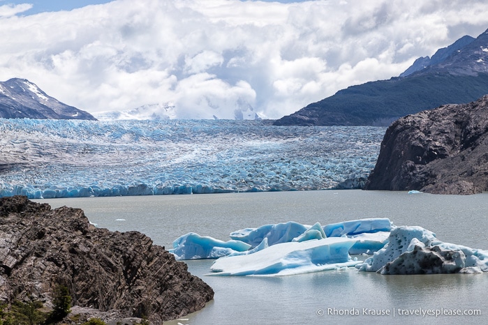
As soon as we reached the top of the hill, we were amazed by the view before us. There was Grey Glacier, its ice covering a wide gap between mountains and spilling into the north end of Lago Grey.
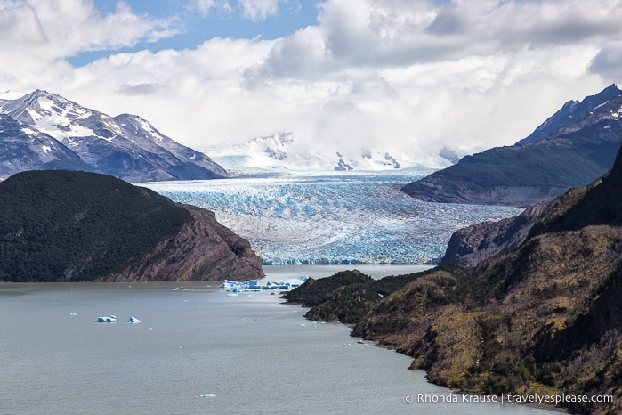
From Mirador Lago Grey we got a good sense of just how big Glaciar Grey is. At 6 km wide and over 30 m high in places, it was definitely an eye catcher! We could even see how the glacier split into three as it flowed around two large rocks (I think the biggest one is actually an island).
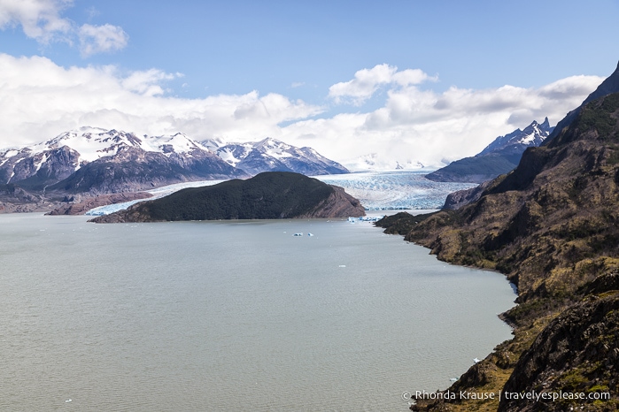
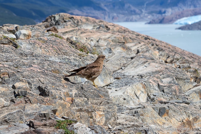
We decided to sit for a while at Mirador Lago Grey, having a snack while we admired the glacier and watched birds soaring above. We also debated whether we should turn around here, so we wouldn’t have to worry about missing the ferry, or continue on to the viewpoint closer to the base of the glacier.
Mirador Lago Grey is located approximately at kilometer 6, so we had about another 5.5 km to go until we reached the next nearest viewpoint at Grey Glacier.
Fearing I’d have regrets about not doing the full Grey Glacier hike, we decided we had the time and energy to keep going. So, off we hurried down the steep trail towards the glacier.
As the trail descended, we could still see the glacier in the distance but all I could think about was how tough the hike back was going to be. It was a long, sustained slope that would definitely slow us down on the return trip when we had to climb it.
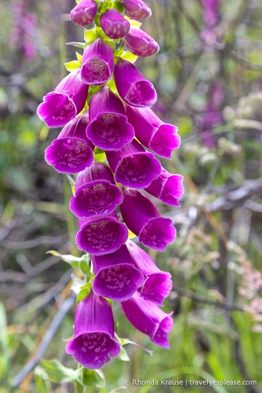
As we got closer to the bottom of the hill, the path became more forested and there weren’t many good views of Lago Grey, even though we were walking beside it. However, I was happy to come across some bright purple flowers adding colour to the trail.
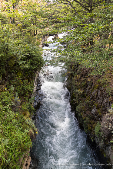
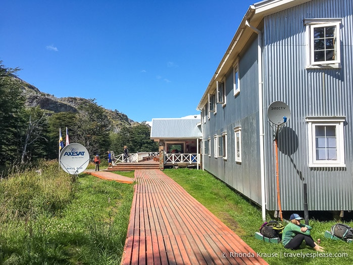
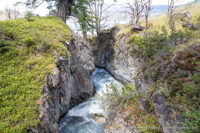
At the bottom of the hill we came to a wooden bridge crossing over Rio Olguin and then the trail made some more ups and downs before finally arriving at Refugio Grey.
We continued walking past the campsite and then turned left at the fork in the trail. There was a sign here indicating it was the way to the base camp for ice hikes and kayaking. From this point it was less than a kilometer before we reached the viewpoint.
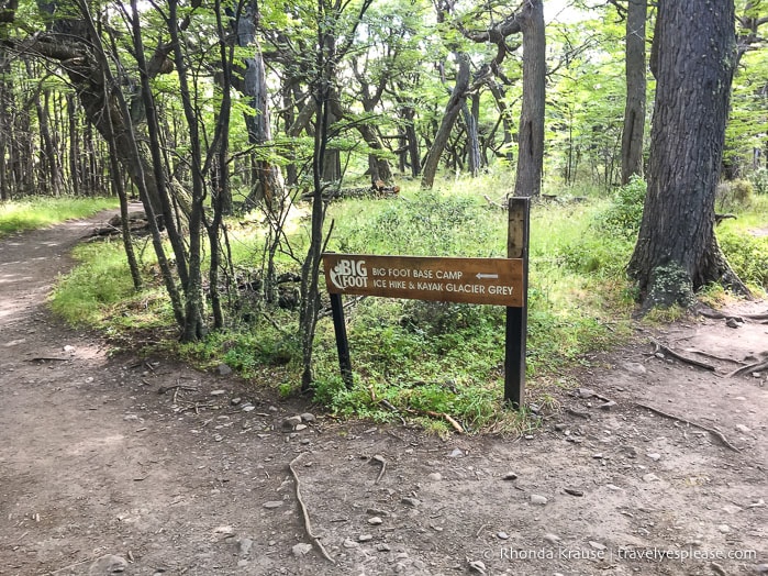
If you go right instead, you’ll come to some other viewpoints and a suspension bridge, but the distance is farther than the viewpoint on the left. Had we gone right we might have missed the ferry, so I don’t recommend this unless you’re spending the night at the refugio or are a very fast hiker.
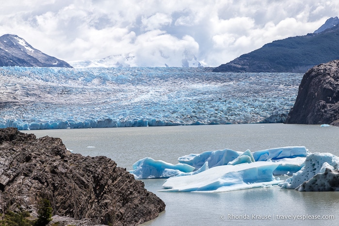
Anyways, after the junction it wasn’t long until Grey Glacier came into view. Since we were on a tight schedule, we stopped at the nearest viewpoint instead of going all the way to the end of the trail.
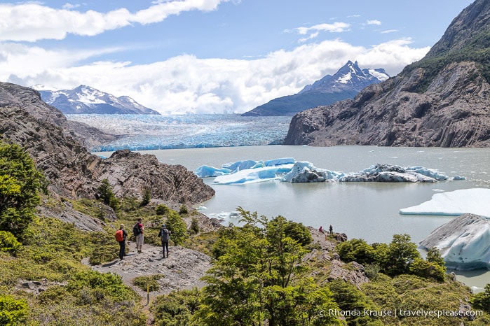
From here we could see Grey Glacier at the end of the lake and got an up-close view of some icebergs floating in the bay.
After a very quick lunch break, we started the long hike back the way we came.
Just like I expected, the hill to Mirador Lago Grey was not fun and felt like it was never going to end. Still, I remained very determined to get to the top, knowing from there it would be smooth sailing with more elevation loss than gain.
I had such an adrenaline rush from the stress of having to catch the ferry that I managed to keep a faster pace than I did the day before on an easier trail. Once a storm started rolling in behind us, we picked up the pace even more out of fear of getting caught in some dangerous winds.
Thanks to all my panicked rushing, we made it back to the trail by 5:20 pm- with 75 minutes to spare before the last ferry of the day. I guess I didn’t have to worry so much, but I’d still rather have a time buffer in case we ran into trouble on the trail.
Final Thoughts About the Grey Glacier Day Hike
I’m glad we did the Grey Glacier hike because the ice field and Lago Grey were definitely worth seeing. We also liked that the trail was the least busy of our three day hikes in Torres del Paine National Park, so it had a pleasant atmosphere.
While the vista from the end of the trail was beautiful, the glacier didn’t “wow” me as much as Argentina’s Perito Moreno Glacier did. Perhaps if we had time to explore the trail that gets closer to the right side of the glacier, it would have been more awe-inspiring.
In hindsight, I think I could have been satisfied turning around at Mirador Lago Grey if we didn’t have the time or energy to hike closer to Grey Glacier, especially since I’ve seen plenty of glaciers before.
Either way, I don’t regret hiking to Grey Glacier and I’m glad we experienced this section of the W Trek. I just happened to enjoy our French Valley hike and the hike to Mirador las Torres more.
Grey Glacier Hike Guide- Tips for Hiking to Grey Glacier
Trail Details: Here is some information about the trail to Grey Glacier so you can prepare for your hike.
- Type of Trail– Out and back
- Start and Finish Points- Paine Grande refugio
- Distance- 22.9 km/14.2 mi
- Elevation Gain- 573 m/1880 ft
- Difficulty- Hard (with some moderate sections)
- Time Required- 7- 8 hours
According to my GPS recording, the Grey Glacier day hike took us 7 hours and 23 minutes at an average speed of 3.1 km/hr. We walked for 6 hr 32 min and rested for 51 min. Our average moving speed on the trail was 3.5 km/hr (max of 5.7 km/hr) and our pace was 19.20 min/km. It’s important to keep track of your pace so that you know where/when to turn around in order to make it back in time for the last ferry.
Best Time to Hike: The best time to do the Grey Glacier hike in Torres del Paine National Park is in summer (December to February) because of the warmer temperatures and long daylight hours.
Getting to the Trailhead: The Grey Glacier hike starts on the west side of Lago Pehoe in the centre of the park.
- To get to the trailhead at the Paine Grande refugio, you will need to take a 30 minute ferry ride across Lago Pehoe. The boat leaves from the dock behind Cafeteria Pudeto.
- The ferry schedule changes throughout the year and an up to date itinerary and rates can be found here. To hike to Grey Glacier as a day trip, plan to catch the earliest ferry leaving Pudeto in the morning (8:30 am in high season) and the latest one leaving Paine Grande in the evening (6:40 pm in high season).
- At the time of our visit, ferry tickets were paid for with cash once you’re on the boat, but you can now purchase them in advance online. I haven’t been able to confirm if you can still pay on the boat or if you have to buy tickets online instead. The ferry’s website gives the option to pay in U.S. dollars or Chilean pesos. When we visited, we were able to pay in Chilean pesos on the boat.
- The first and last ferries of the day are the most popular and people start lining up before the departure time, so it’s best to arrive early.
Park Pass: You must have a park pass to hike to Grey Glacier and there are ranger stations where you could be asked to show it. Buy your park pass at one of the park gates and make sure to bring it with you on the hike.
Facilities: There are public washrooms at Paine Grande and Refugio Grey. You can also buy food and drinks at both those locations.
Gear/What to Bring: You will need proper hiking shoes because the trail is rocky, goes up and down a lot, and is steep in places. Hiking poles come in handy, especially on the hill between Mirador Lago Grey and Grey Glacier.
- Dress in layers because the weather in the mountains can change quickly. Patagonia is notorious for its strong winds, so keep that in mind when deciding what clothing to bring.
- Bring a lunch, snacks, and plenty of water.
- There are large portions of trail without shade so wear sun protection.
Safety: Always hike within your comfort zone. If you don’t think you’ll have the energy (or time) to do make it all the way to Grey Glacier and back, you should turn around at Mirador Lago Grey.
- Avoid hiking in poor weather because much of the trail is exposed to the elements.
Information was correct at the time of publishing, but can change without notice. Please confirm directly with service providers.
Accommodations in Torres del Paine National Park
For your convenience, here is a list of HOTELS IN TORRES DEL PAINE NATIONAL PARK and PUERTO NATALES. Please consider booking your accommodations through the included link. It costs nothing extra and helps support this website. Thank you!
More Patagonia Destinations and Travel Guides
- 2 Weeks in Patagonia- Our Patagonia Itinerary for Adventure in Argentina and Chile
- MOUNT FITZ ROY HIKE- HIKING TO FITZ ROY AND LAGUNA DE LOS TRES IN EL CHALTEN
- HIKING IN TIERRA DEL FUEGO NATIONAL PARK- HOW TO SEE THE PARK ON FOOT