Hiking in Tierra del Fuego National Park- How to See the Park on Foot
Purchases made through links earn us a small commission, at no extra cost to you.
Tierra del Fuego National Park (Parque Nacional Tierra del Fuego) is the southernmost national park in Argentina and one of the top attractions near Ushuaia, the world’s most southern city. The park is known for its coastal scenery, subantarctic forest, and having the southern terminus of the Pan-American Highway within its boundaries.
We had a few days in Ushuaia before embarking on our cruise to Antarctica and South Georgia, so we decided to spend some time hiking in Tierra del Fuego National Park. Since there are several trails for hiking in Tierra del Fuego, we were able to choose a route that went from one end of the park to the other, seeing as much as we could in one afternoon.
Hiking in Tierra del Fuego National Park- Trails and What You Will See
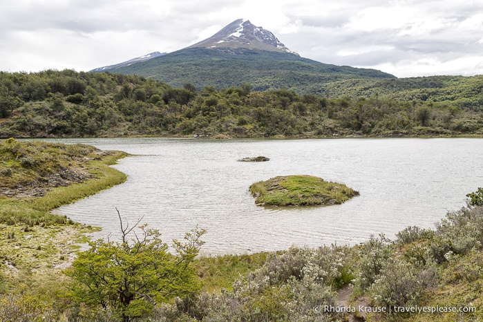
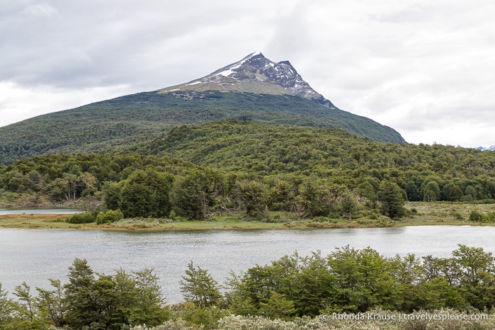
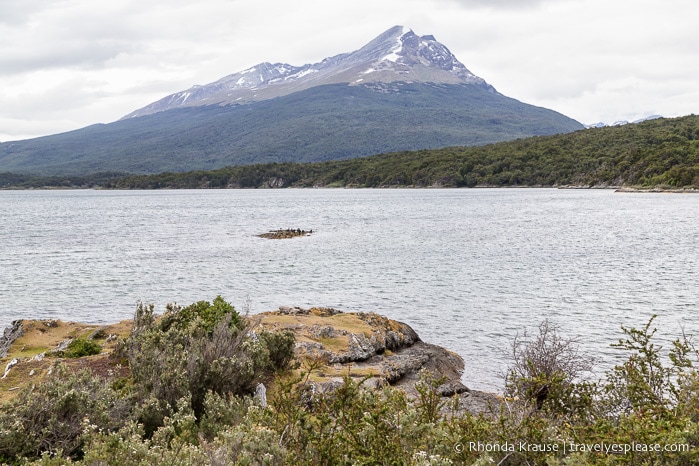
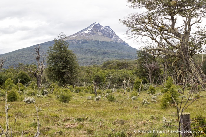
Hiking is one of the best things to do in Tierra del Fuego National Park because it exposes you to a variety of landscapes and scenery. There are mountains, lakes, rivers, and a scenic bay and channel.
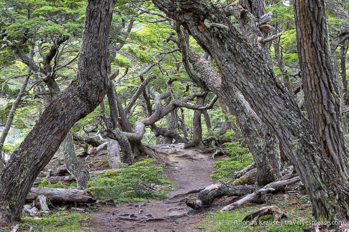
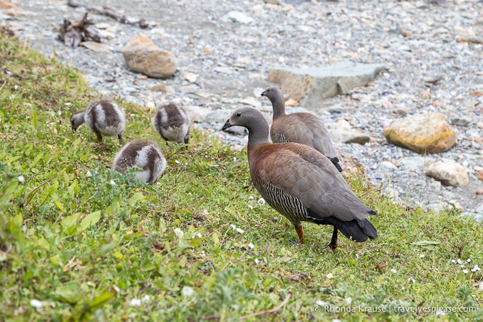
While hiking in Tierra del Fuego National Park you’ll also see some interesting flora and fauna. The area is home to plenty of southern beech woods like lenga (a deciduous tree) and guindo (an evergreen), as well as winter’s bark trees. As for animals, we saw a lot of birds including some ashy-headed geese with chicks.
There are ten marked hiking trails in Tierra del Fuego National Park- four moderate to strenuous hikes and six shorter, easy trails.
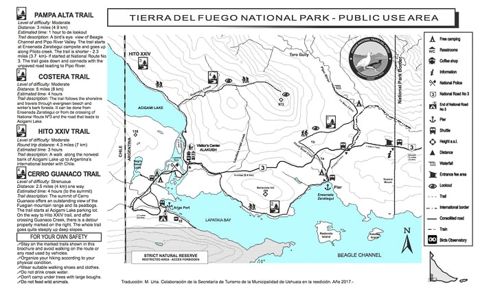
The longer Tierra del Fuego National Park hikes include Pampa Alta Trail (4.9 km/3 mi), Costera Trail (8 km/5 mi), Hito XXIV Trail (3.5 km/2.2 mi), and Cerro Guanaco Trail (4 km/2.5 mi). *distances are one-way and approximate
The shorter trails in Tierra del Fuego National Park can be found in the Lapataia Bay area at the end of the park. These include Paseo de la Isla (1.4 km/0.9 mi), Laguna Negra (500 m/0.3 mi), Mirador Lapataia (1.1 km/0.7 mi), Del Turbal (2 km/1.2 mi), Castorera (1.3 km/0.8 mi), and Senda de la Baliza (1.5 km/0.9 mi). *distances are one-way and approximate
When planning your Tierra del Fuego hikes, keep in mind that there’s no public transportation in the park. If you arrive by shuttle bus from Ushuaia (more information about that later), plan to do hikes that start and end near a shuttle stop.
Our Tierra del Fuego National Park Hiking Route- How to See the Park on Foot
We only had one day in Tierra del Fuego National Park and wanted to see as much of it on foot as possible, so I planned a hike that incorporated three different trails and two small segments of road. When linked together, the route took us about two-thirds of the way across the length of the park.
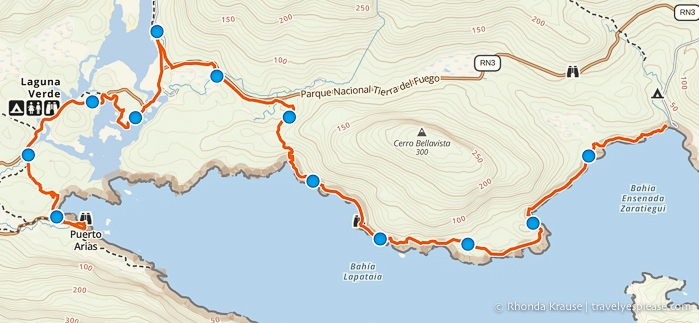
We started our hike at Ensenada Zaratiegui, in the east end of the park, then walked all the way to the end of Route 3, at the west end of the park. We took a lunch break at the Alakush Visitor’s Centre and made several stops to enjoy the scenery along the way.
This hiking route took us from about 11:50 am to 5:30 pm, giving us an hour and a half to relax at the end of Route 3 before the last shuttle bus of the day arrived at 7:00 pm. The total distance hiked was approximately 12 km/7.5 mi with 150 m/492 ft elevation gain.
Here’s a description of our Tierra del Fuego National Park hiking route.
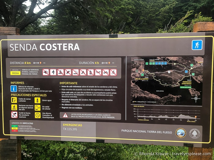
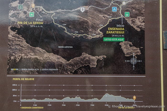
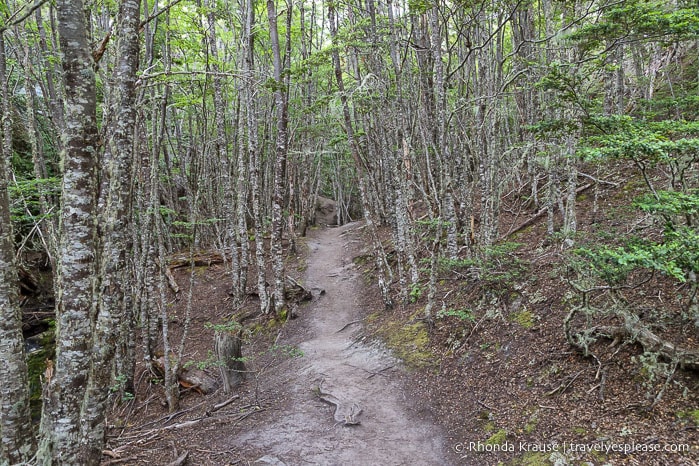
Segment 1: Senda Costera (Coastal Trail)
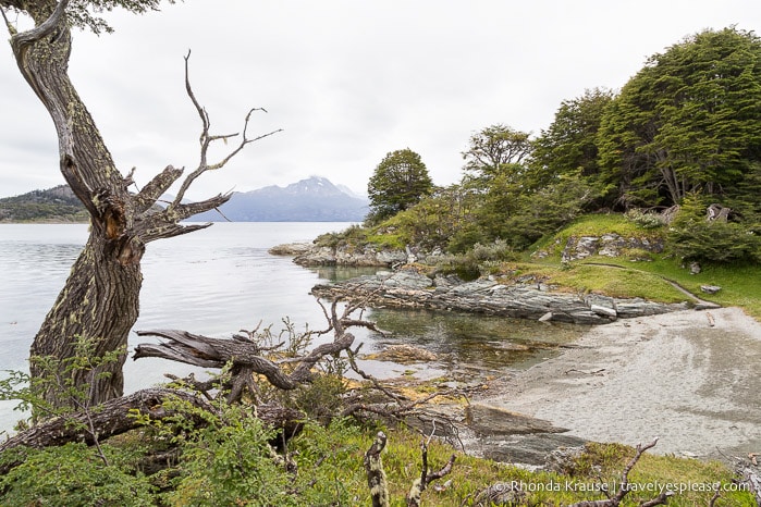
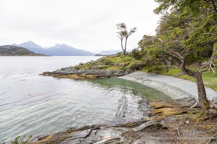
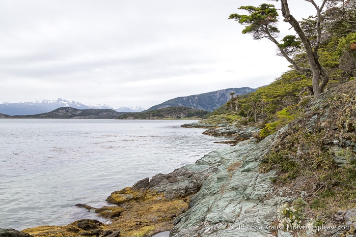
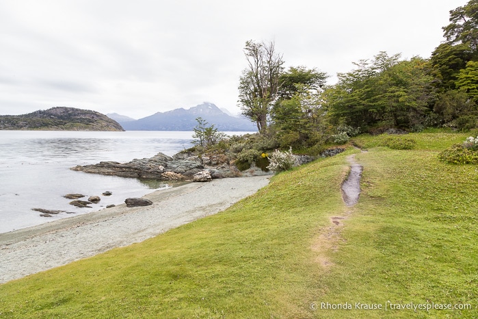
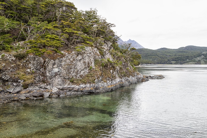
The Coastal Trail (Senda Costera) is the longest trail in Tierra del Fuego National Park. It starts at Ensenada Zaratiegui, near the Post Office at the End of the World, then follows the coast along part of the Beagle Channel and Lapataia Bay before ending at the access road to the visitor’s centre.
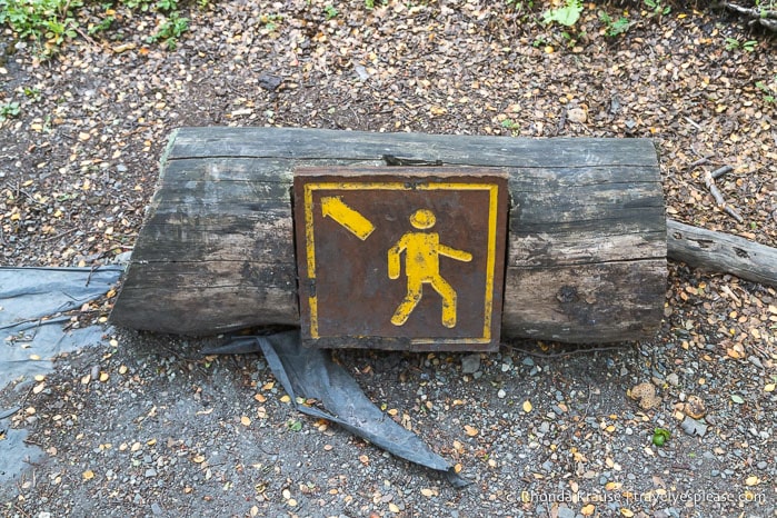
After briefly visiting the post office and admiring the view from the beach, we headed towards the forest where the trail begins at the top of a set of stairs. There was a sign with a map and some information about the hike.
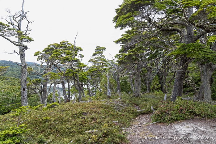
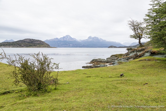
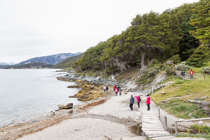
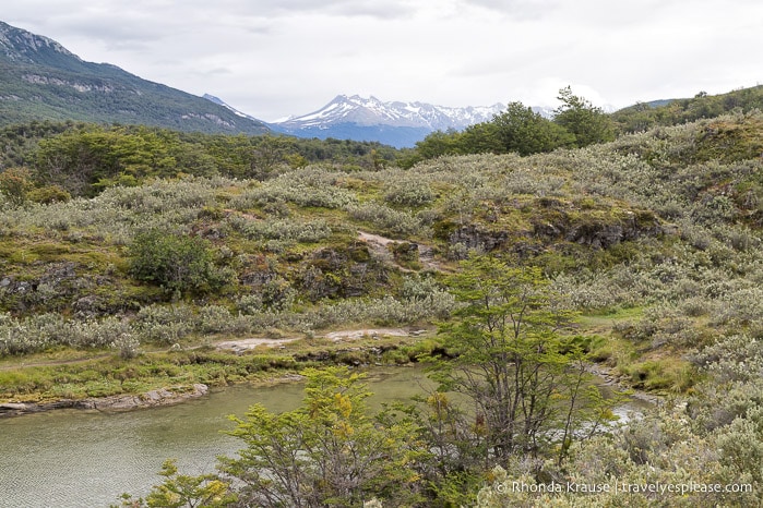
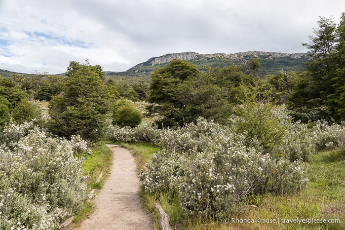
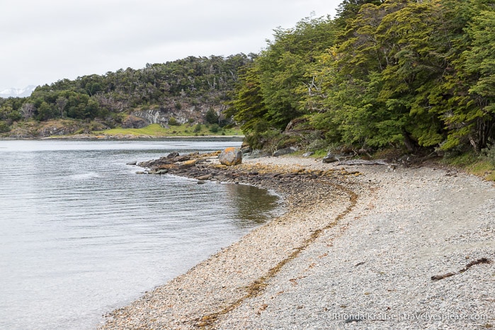
The first part of the hike gave us a nice preview of what we could expect on the Coastal Trail. There were views of the rocky coastline, distant mountains and hills, and a forest of beech trees.
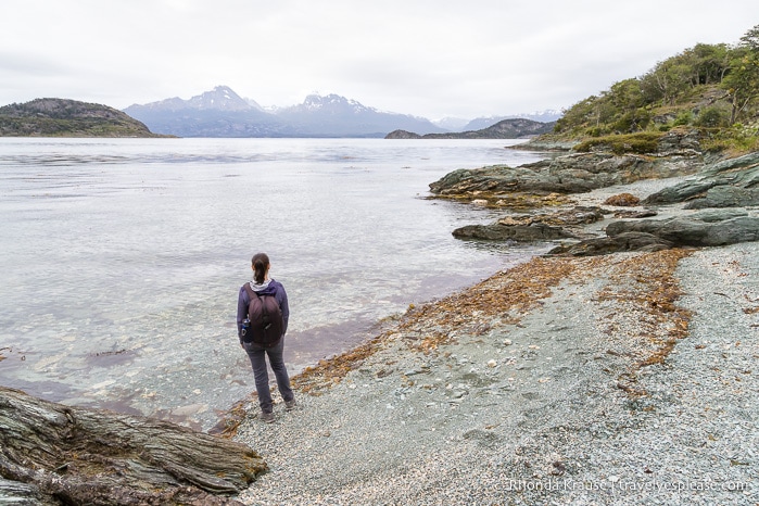
We soon came to a pebbly beach that had a lot of pretty purple shells. It was a lovely spot to hang out for a few minutes and take some pictures before continuing our hike.
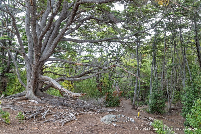
As we made our way along the Coastal Trail we were shaded by towering trees. Even though we were in the forest, the shoreline was close and we got plenty of views of the water between crooked branches of old, mossy trees.
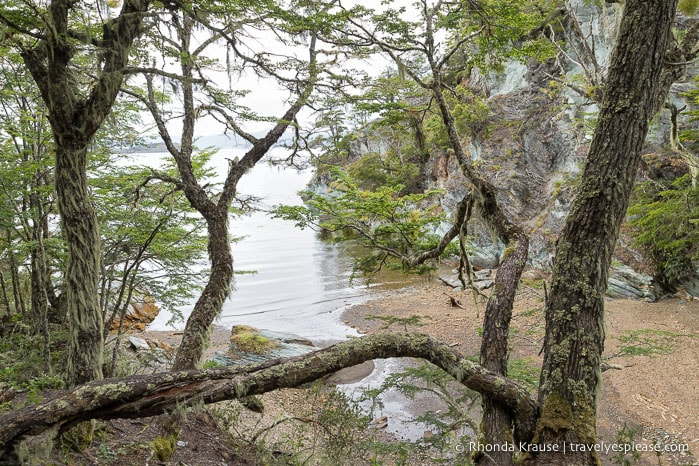
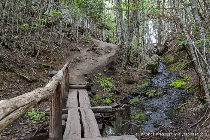
As the trail continued on, there were frequent minor elevation changes, but nothing that was difficult or steep. We passed by some colourful berry bushes and several small beaches as the path weaved back and forth from coastline to forest.

During our hike, we saw a family of ashy-headed geese on one of the beaches and a large group of birds we couldn’t identify on a distant island.
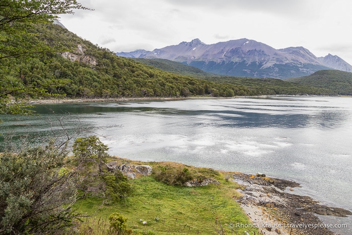
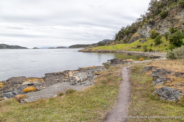
At approximately ¾ of the way into the hike there was a large hill, then the trail began a gradual descent away from the coast and towards Route 3, which it ran beside for the final leg of the hike. The last notable scenery was an open meadow that was overlooked by a mountain.
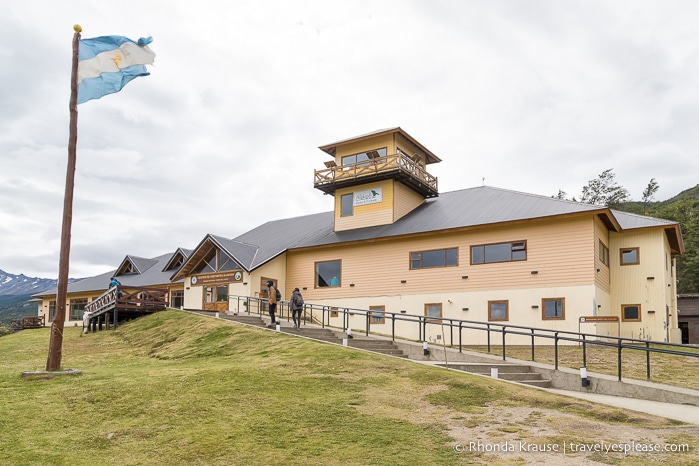
The trail ended at a junction with Route 3 and the access road to Alakush Visitor’s Centre. We continued straight, crossing Route 3, and walked along the road to the visitor’s centre where we took a lunch break.
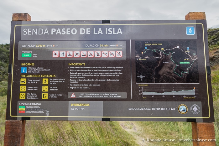
Segment 2: Paseo de la Isla (The Island Hike)
The Island Hike (Paseo de la Isla) is an easy trail that starts near a police station on the other side of Lapataia River and ends at Mirador Laguna Verde.
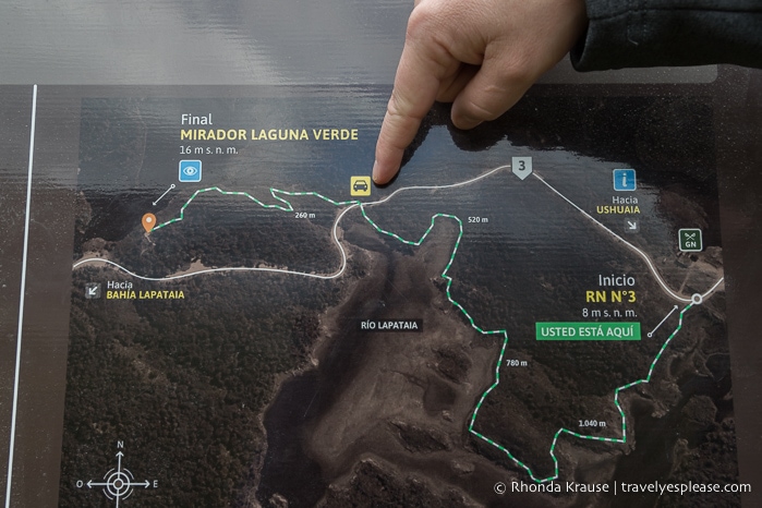
After leaving the visitor’s centre, we crossed a red bridge and walked a short distance until we saw a sign marking the trailhead. Looking at the map, we decided we would exit the trail at the road junction because we weren’t sure if the section to Laguna Verde was a through route back to the road or if we’d have to retrace our steps. Turns out the end of the trail did connect to the road.
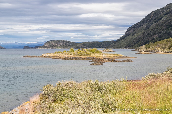
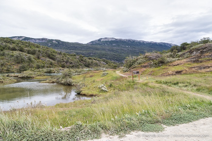
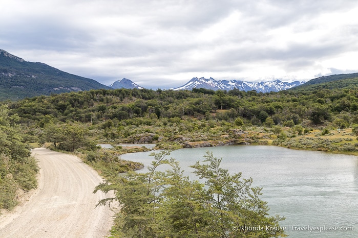
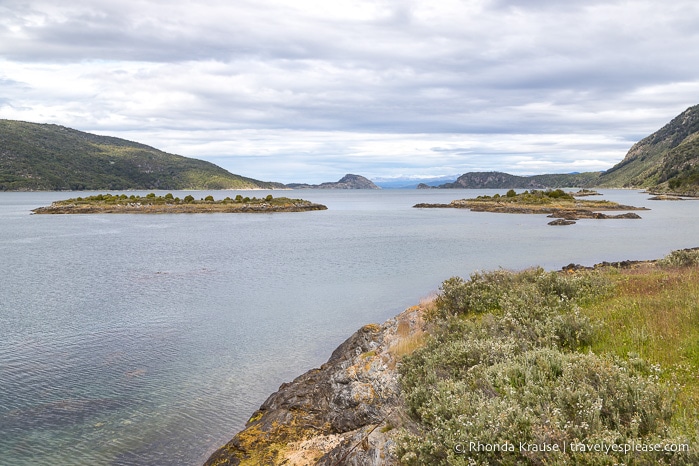
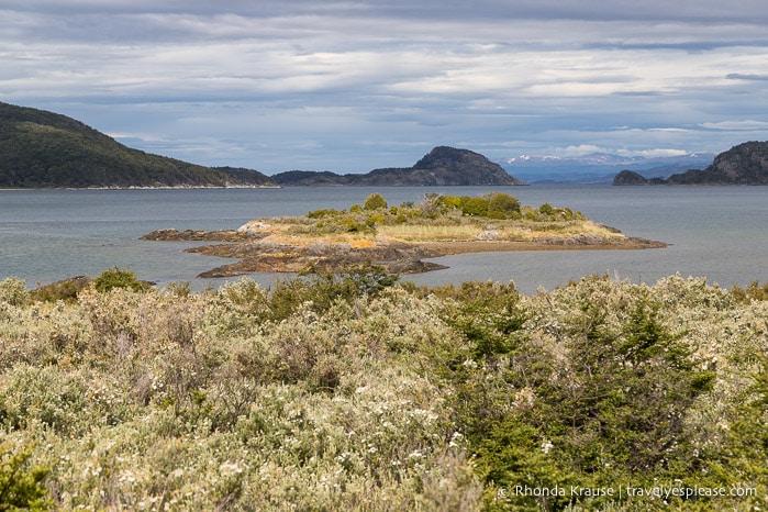
This trail traversed across low, shrub-covered hills as it followed the zigzagging shoreline of Lapataia River.
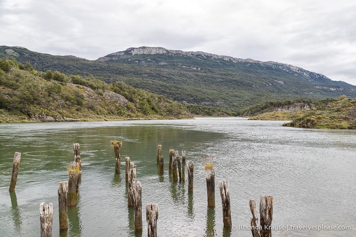
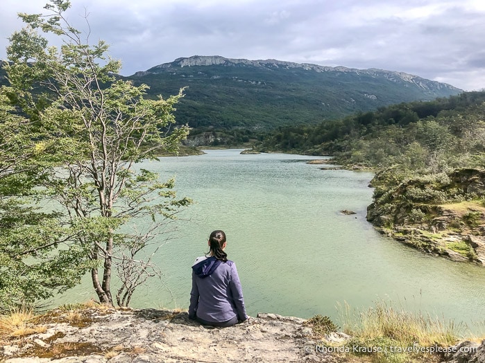
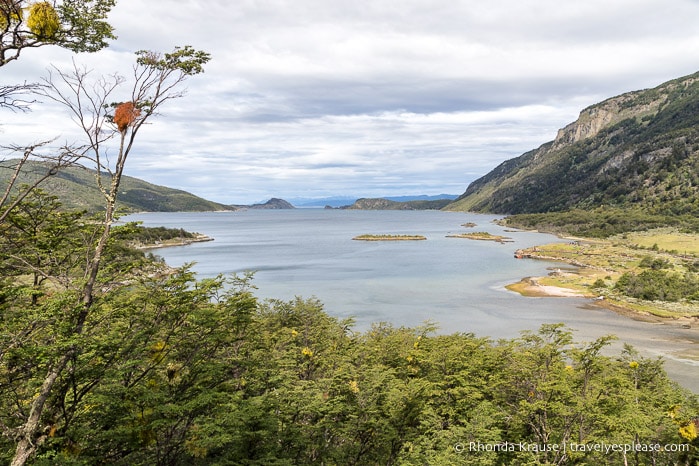
As we walked the trail we enjoyed wonderful views of the river and its islands, as well as the mountains that overlook it.
Once we reached the junction with Route 3, we decided to walk along the road instead of continuing straight on the trail to Laguna Verde. After the fact I realized that both routes are about the same length, so in hindsight I would have stayed on the trail instead of walking on the road.
We followed the dirt road all the way to the next trailhead. Even though we weren’t on a hiking trail, there were still some great views of Ovando River to enjoy. The only downside was that vehicles would kick up a lot of dust when they went by, but thankfully that wasn’t too often.
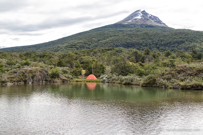
After passing by a campground and crossing the river, we soon came to the next trail of our Tierra del Fuego National Park hike.
Segment 3: Mirador Lapataia (Lapataia Lookout)
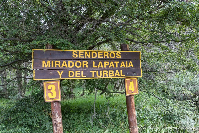
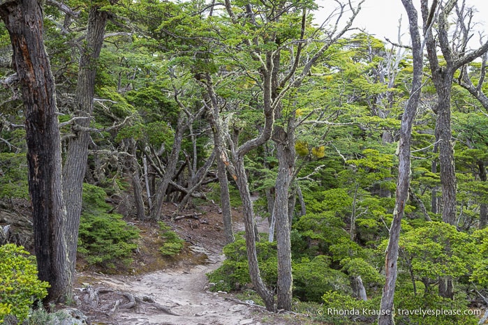
The final trail we hiked in Tierra del Fuego National Park was Senda del Mirador. This path leads to Mirador Lapataia and then proceeds to the end of Route 3 at Lapataia Bay.
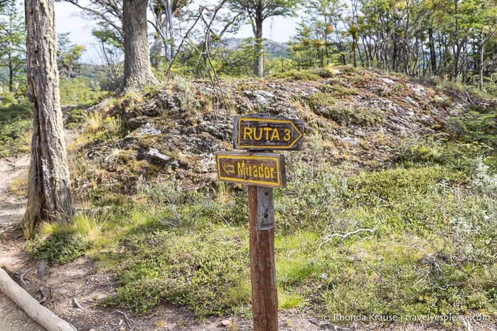
This trailhead is also the starting point for the Del Turbal hike, so we made sure to follow trail #3 to get to the lookout point.
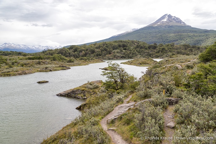
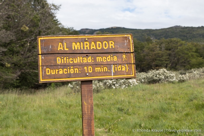
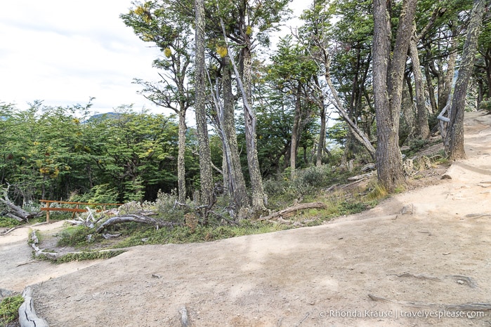
The trail passed through an area of bushes and low trees then made a gentle ascent towards Mirador Lapataia. Once we reached a junction, we followed the sign directing us to the mirador.
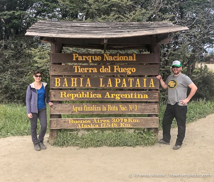
At the end of this short spur trail we arrived at a viewpoint looking out onto Lapataia Bay. We could even see the end of Route 3, our final destination, and watched as the 5:00 pm shuttle we were hoping to catch drove away.
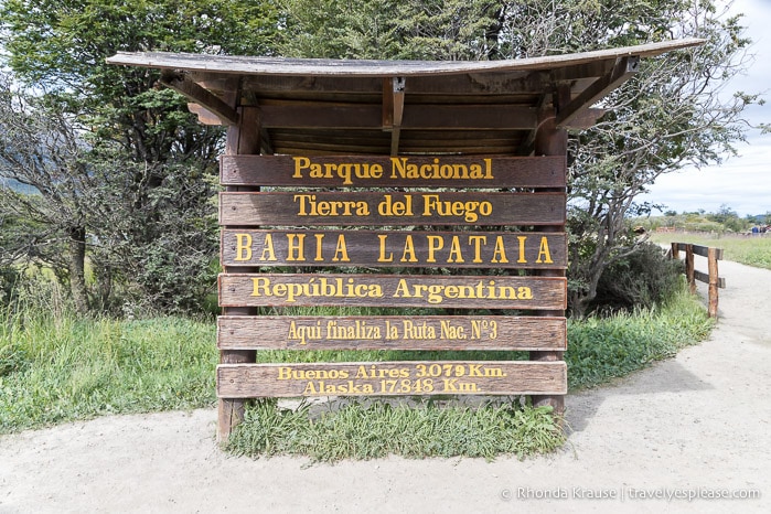
After we were finished at the viewpoint we retraced our steps back to the main trail. At the junction we turned right and followed the path as it curved downhill towards the bay. It wasn’t long until we arrived at the sign marking the end of Route 3 and the Pan-American Highway.
Since we had a lot of time to kill until the last shuttle of the day at 7:00 pm, we walked the boardwalk loop at Puerto Arias and sat and chatted with other travellers as we gazed across Lapataia Bay.
Final Thoughts About Hiking in Tierra del Fuego National Park
We really enjoyed hiking in Tierra del Fuego National Park and it was the perfect warm up for the longer, more challenging hikes we would later do during our trip to Patagonia.
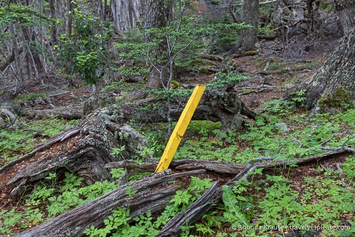
Tierra del Fuego National Park was easy to explore on foot thanks to the close proximity of several hiking trails that could be conveniently linked to form a route from one end of the park to the other. The trails were also well marked with signs and yellow stakes so we didn’t worry about getting lost.
We thought the route we chose to hike was the best way to make the most of our time in the park. In one afternoon we walked 12 km across the park and got to experience three different trails.
Our favourite thing about hiking in Tierra del Fuego National Park was the coastal views and the trees, especially getting to see the southernmost tree species on Earth. It was also pretty exciting to arrive at the terminus of the Pan-American Highway, the furthest south we had ever been until our trip to Antarctica a few days later.
Tips for Visiting Tierra del Fuego National Park
Location: Tierra del Fuego National Park is located near the southern tip of Argentina on Isla Grande de Tierra del Fuego (the largest island of the Tierra del Fuego archipelago).
- The park’s entrance is about 11 km (20 minute drive) from central Ushuaia.
Getting to Tierra del Fuego National Park: Tierra del Fuego National Park can be reached from Ushuaia by shuttle bus, rental car, or taxi. The most common (and cheapest) way to get to the park is by shuttle bus, which is what we did.
Shuttle from Ushuaia to Tierra del Fuego National Park- The shuttle buses to Tierra del Fuego National Park depart from the main bus terminal in Ushuaia at Avenida Maipú and Juana Genoveva Fadul. Tickets are bought on site and can’t be purchased in advance. There are several bus operators so when you go to the booth to buy your ticket you will be assigned to one of the companies. We were given different companies for there and back.
- The ticket staff will ask which shuttle stop in the park you want to get off at and return from, so you need a plan for your visit (there is no hop-on-hop-off shuttle service in the park). Staff and/or drivers should have a map of the park to show you, if not, you can get one at the tourist information office a block away or download it here. Make sure you buy two shuttle tickets, one to get there and one to return, and that you get on the bus that matches the name on your ticket.
- The shuttle schedule is not posted online (at the time of this writing) and changes depending on the season, number of tourists etc. Shuttles operate daily and leave frequently throughout the day. Return times from the park are typically at 3:00 pm, 5:00 pm and 7:00 pm, varying slightly depending on the stop. To make things easier, we had the ticket office write down the departure times for each shuttle stop on our map. In our experience, the shuttle stops were actually less than what was shown on the map. The shuttle stops in the park were- the entrance gate, Ensenada Zaratiegui (where the Post Office at the End of the World is), Alakush Visitor’s Centre, and the end of Route 3.
- Overall, the shuttle process felt disorganized and since there was no published schedule, we had to wait until we got to Ushuaia to plan our visit to Tierra del Fuego National Park. Thankfully everything went smoothly and taking the shuttle turned out to be easier than it looked!
Taxi from Ushuaia to Tierra del Fuego National Park- If you take a taxi, it’s best to hire one from Ushuaia for the day (or however many hours you want to visit the park). The driver can take you to the main attractions in the park or drop you off at the hikes you want to do and wait for you at the end of the trail.
- Hiring a taxi one-way from Ushuaia is not recommended because it’s very rare to find a taxi in the park to take you back to town. Your best chance to get a taxi is at the End of the World Train Station, just outside the park, but getting there is a long walk on a dusty road. I personally would be too worried that there wouldn’t be a taxi waiting at the train station, especially if it was late in the day.
Entrance Fees/Park Pass: Visitors are required to buy a park pass at the entrance gate. If you visit twice in 48 hours you get a 50% discount off the second day’s entrance fee. Current prices for Tierra del Fuego National Park can be found here.
- The shuttles stop at the entrance and let everyone off to pay their admission fee in the office.
Alakush Visitor’s Centre: The visitor’s centre is located beside the Lapataia River, near Acigami Lake, and offers a restaurant, public restrooms, gift shop, cultural exhibits, and an information desk.
More Information to Plan Your Visit to Tierra del Fuego National Park: The tourist information office in Ushuaia is a great resource for planning your trip to Tierra del Fuego National Park. They can advise on transportation, tours, things to do, and hiking trails in Tierra del Fuego National Park.
Information was updated January 2025, but can change without notice. Please confirm directly with service providers.
Tours of Tierra del Fuego National Park
Here is a trusted site where you can book tours and activities in Tierra del Fuego National Park and in Ushuaia. Here’s one I picked out related to what I’ve mentioned in this post:
Accommodations in Ushuaia
For your convenience, here is a list of HOTELS IN USHUAIA. Please consider booking your Ushuaia accommodations through the included link. It costs nothing extra and helps support this website. Thank you!
More Argentina Destinations and Travel Guides
- Mount Fitz Roy Hike- Hiking to Fitz Roy and Laguna de los Tres in El Chalten
- Visiting Perito Moreno Glacier- A Spectacular Glacier in Los Glaciares National Park
- Buenos Aires Bike Tour- Exploring Buenos Aires by Bike
- VISITING THE BUENOS AIRES JAPANESE GARDEN- A PRETTY PIECE OF JAPAN IN ARGENTINA