Hiking Fairyland Loop Trail- Bryce Canyon National Park, Utah
Purchases made through links earn us a small commission, at no extra cost to you.
There are several great hiking trails in Bryce Canyon National Park that showcase the park’s impressive collection of hoodoos, but one that should not be missed is the Fairyland Loop Trail.
While it might be tempting to shy away from this hike in favour of shorter, equally scenic trails, like the popular Queen’s Garden and Navajo Loop, the Fairyland Loop offers a quieter setting where you can enjoy the mesmerizing rock formations of the Bryce Amphitheatre.
About Fairyland Loop Trail in Bryce Canyon National Park
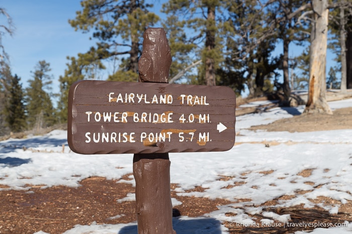
The Fairyland Loop in Bryce Canyon is a more remote trail located in the north end of the park. Since the route is a loop, you can choose to hike the trail clockwise or counterclockwise starting from either Fairyland Point or just north of Sunrise Point.
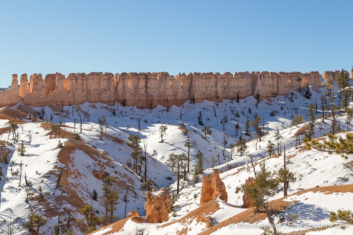
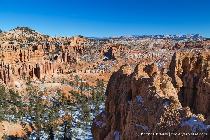
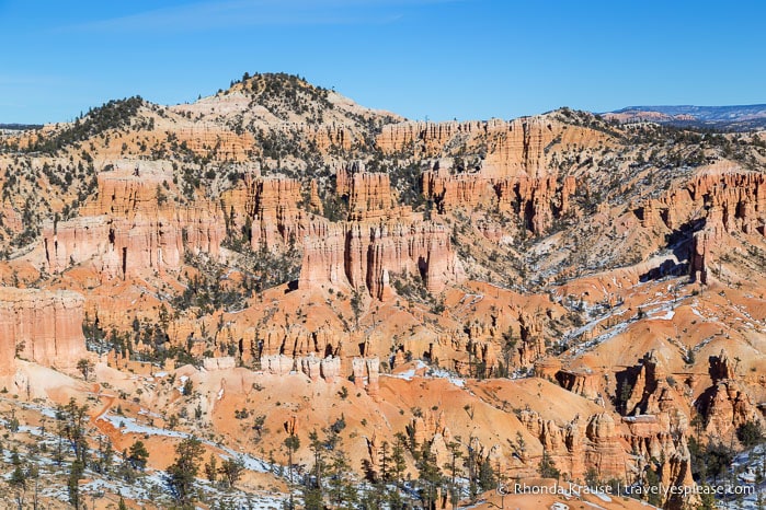
The trail combines hiking along the plateau rim with exploration down in the Bryce Amphitheatre. For 12.9 km (8 mi) the trail meanders around Boat Mesa providing views of Fairyland Canyon, countless colourful hoodoos, and prominent landmarks like the Sinking Ship, Tower Bridge, and Chinese Wall.
The trail has a lot of ups and downs with a total elevation gain of approximately 523 m (1716 ft). Much of the elevation gain/loss happens when climbing in and out of the canyon.
The Fairyland hike is rated moderate to hard and takes 4 to 5 hours to complete.
Hiking Fairyland Loop Trail- Our Experience
We decided to hike Fairyland Loop Trail in a counterclockwise direction starting near Sunrise Point, heading down into the canyon towards Tower Bridge, then exiting the canyon at Fairyland Point and returning via the Rim Trail.
Hiking Fairyland Loop counterclockwise meant that our descent into the canyon would be slightly longer than our climb out. We would also arrive at Tower Bridge earlier, thereby completing the most popular section of trail first (a lot of people choose to just hike to Tower Bridge and back).
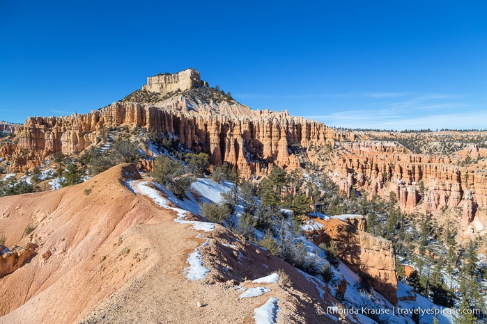
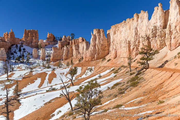
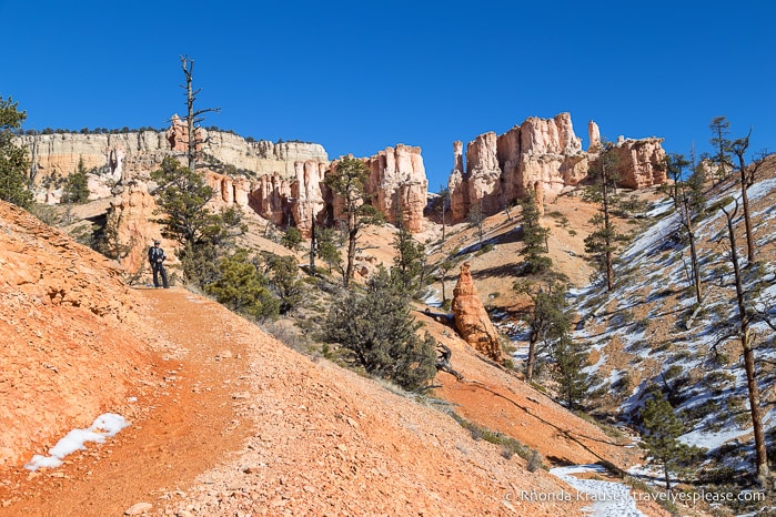
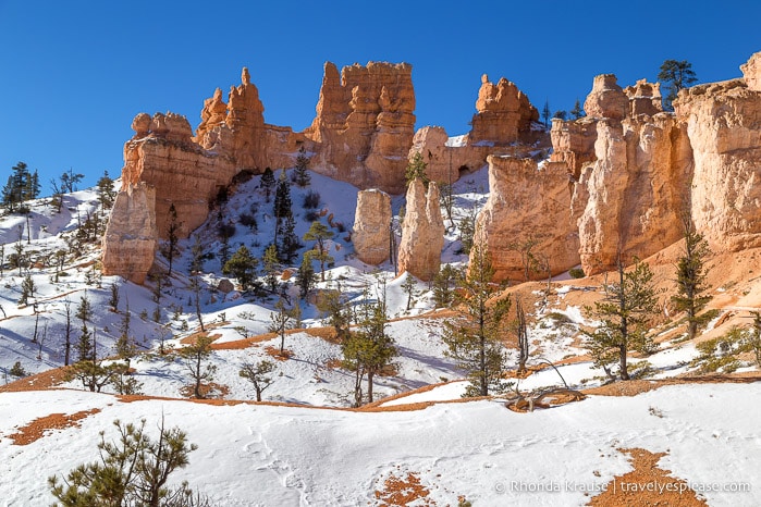
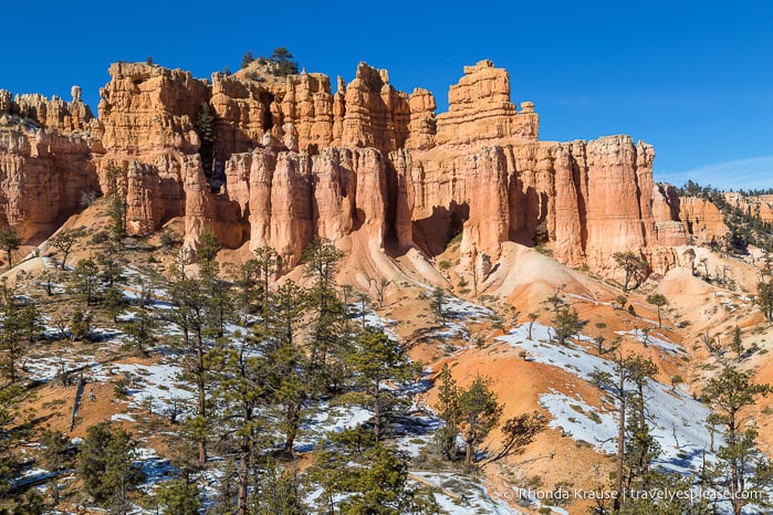
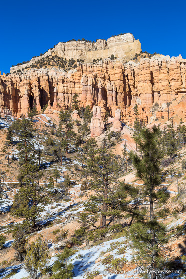
Our hike began with a winding, steady descent down into Campbell Canyon. Even though there were some trees along the trail, we could still see groups of hoodoos and walls of rock off in the distance.
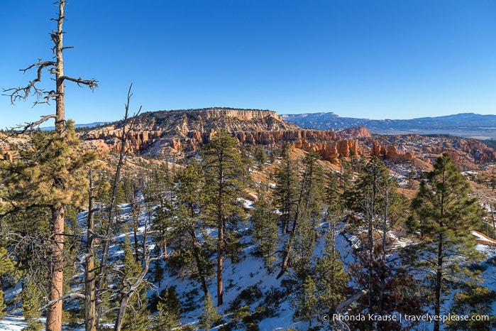
The further into the canyon we hiked the more open the views became. The National Park Service refers to Campbell Canyon as a “hoodoo graveyard” since a lot of the hoodoos have eroded into mounds of dirt.
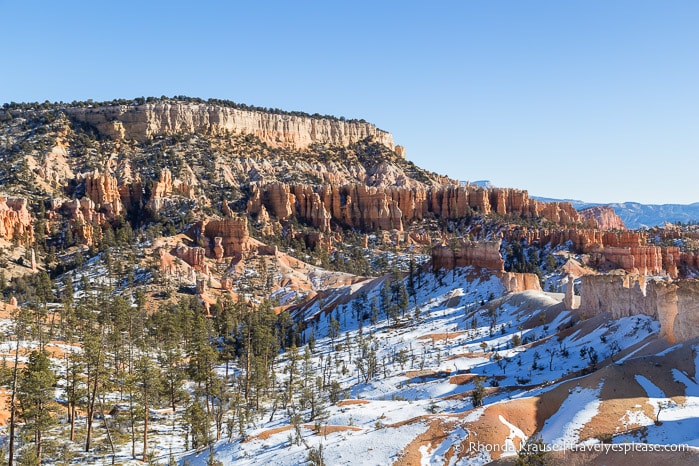
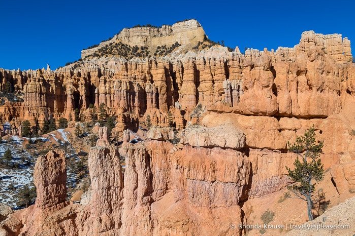
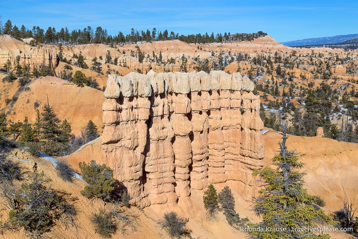
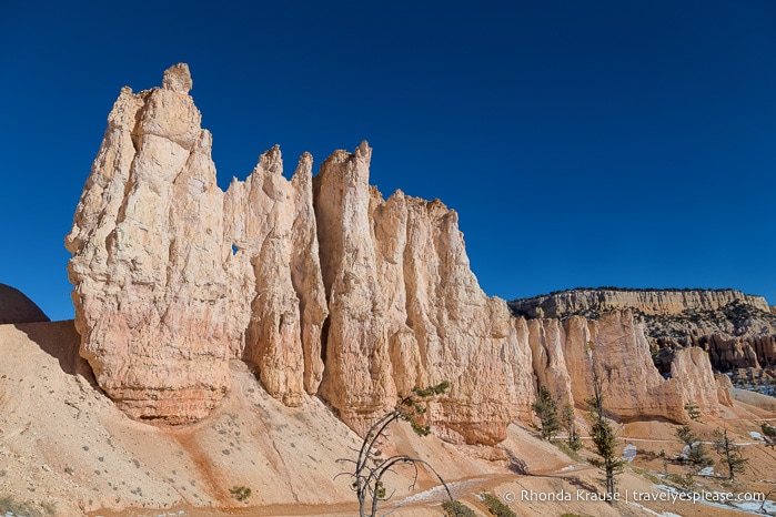
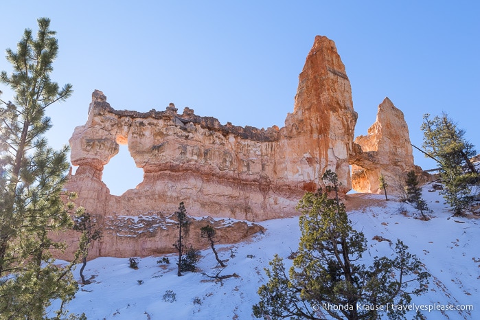
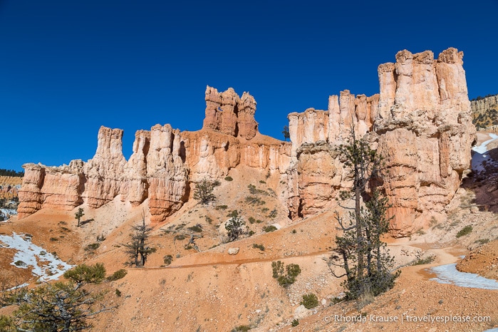
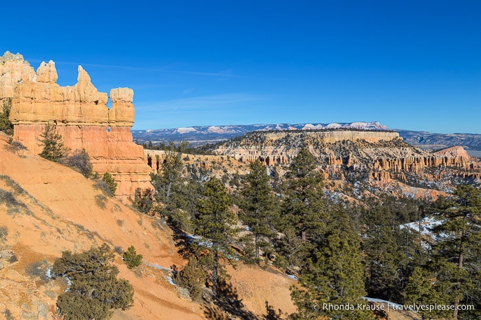
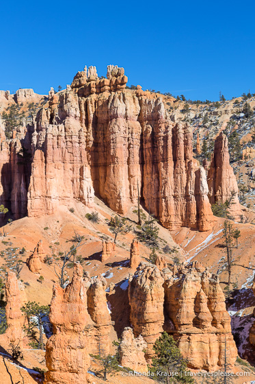
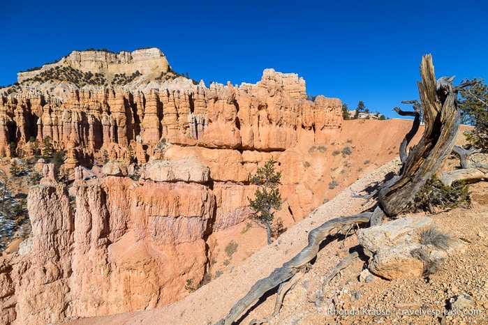
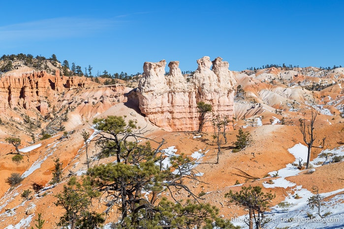
As we continued down the dirt path, the Chinese Wall eventually came into view. This thin wall of rock, called a fin, is a great example of the different stages of erosion at work.
At the Chinese Wall you can see how years of frost-wedging and runoff has enlarged cracks in the fin to create windows. At some points along the wall these windows have collapsed, leaving columns of rock that will continue to erode and be sculpted into hoodoos, like you can see at one end of the fin.
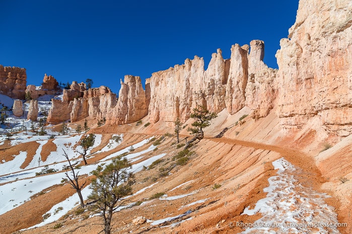
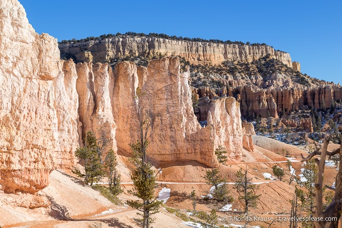
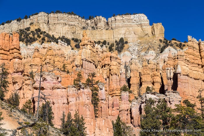
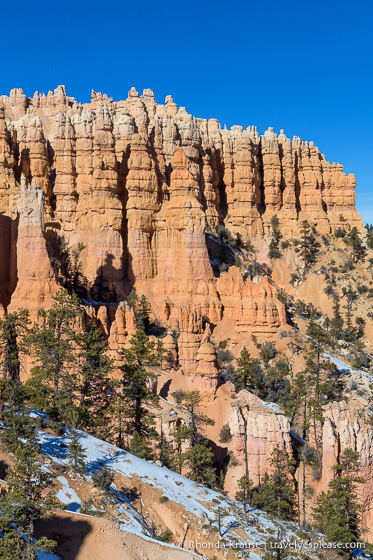
Soon after the Chinese Wall we found ourselves walking alongside the base of another towering, gleaming white fin.
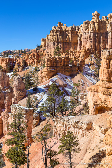
I stopped a lot here to take photos, loving how the trail looked like a slithering snake hugging each curve of the mighty rock wall.
This was just the start of the countless beautiful rock formations we’d get an up-close look at as we hiked Fairyland Loop Trail and we couldn’t wait to see what was next!
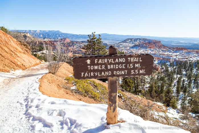
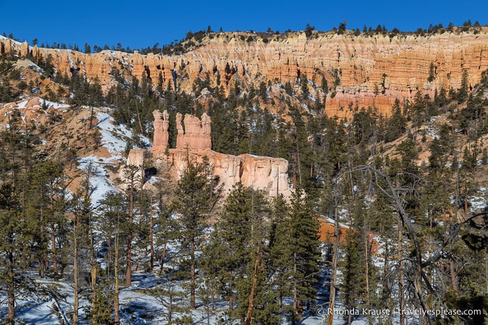
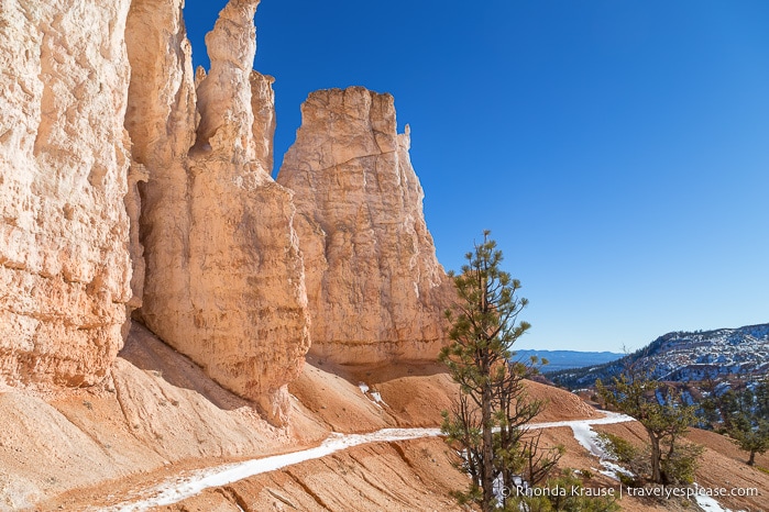
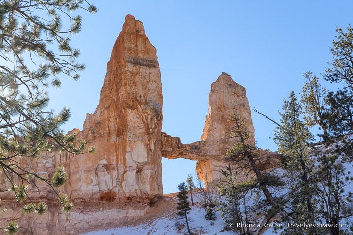
A little further up the path we reached the canyon floor, coming to a sign marking the side trail to Tower Bridge. Off we went down this wooded path to a viewpoint about 183 m (200 yd) up the trail.
At the end of the trail we could see Tower Bridge through the trees, looming above us on a small hill. There was no wondering how the formation got its name, as it was the same shape as the famous Tower Bridge in London.
After admiring the Tower Bridge rock formation, we headed back to the main trail to continue our hike on Fairyland Loop.
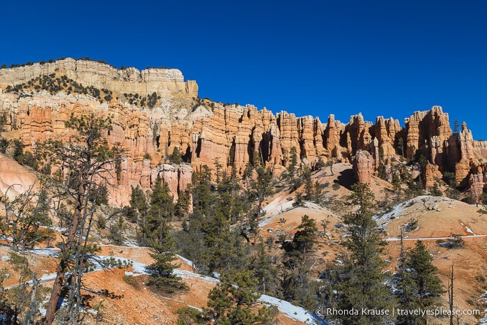
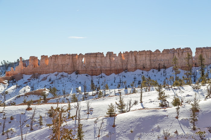
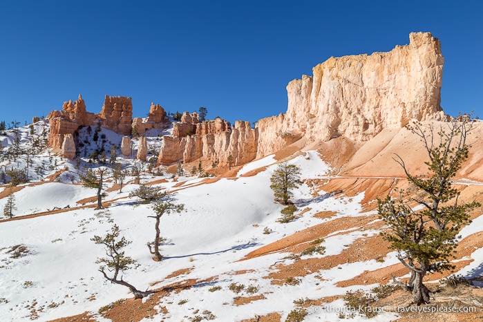
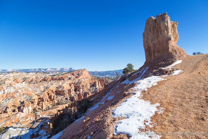
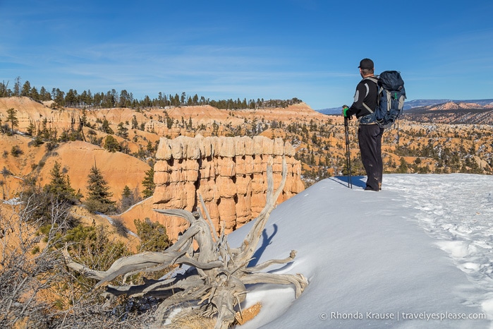
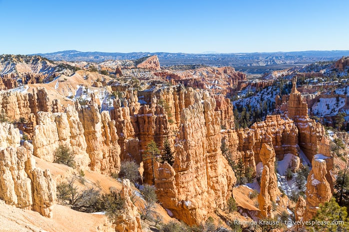
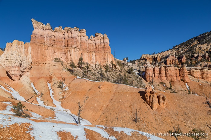
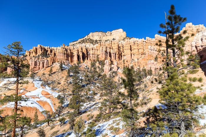
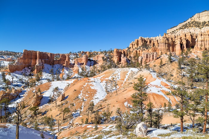
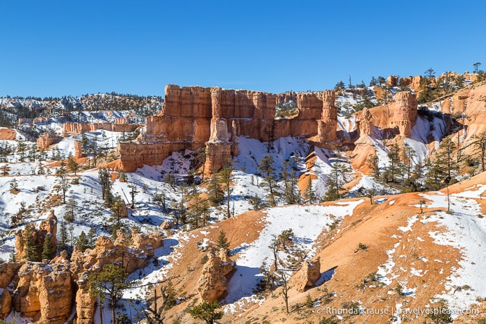
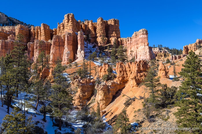
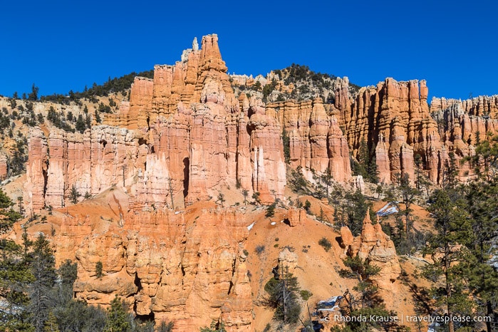
As the trail switchbacked gradually to higher ground, the scenery was constantly changing with views around every corner. There were walls of pinnacles, sparsely wooded valleys, and layers of colour in the sandy slopes below us.
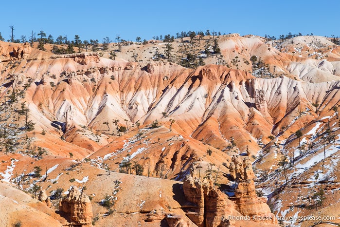
Making our way along the ridge to the most easterly point on the trail, there were incredible panoramic views of Fairyland Canyon, Boat Mesa, and the angular Sinking Ship formation.
It was such a photogenic part of the trail and the hoodoos really inspired my imagination as I looked for familiar shapes in the rock. Sure enough, I noticed a formation that resembled a cat.
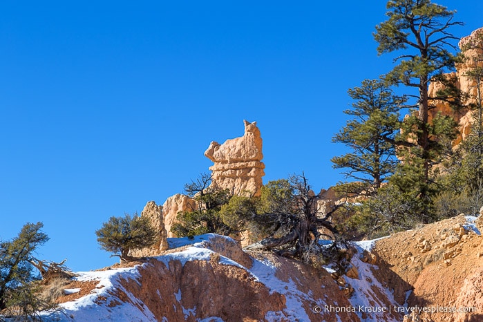
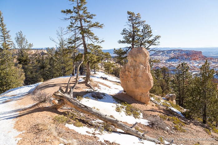
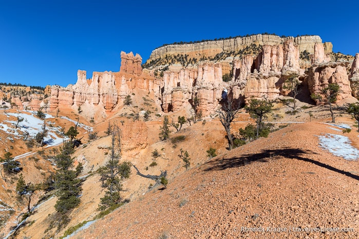
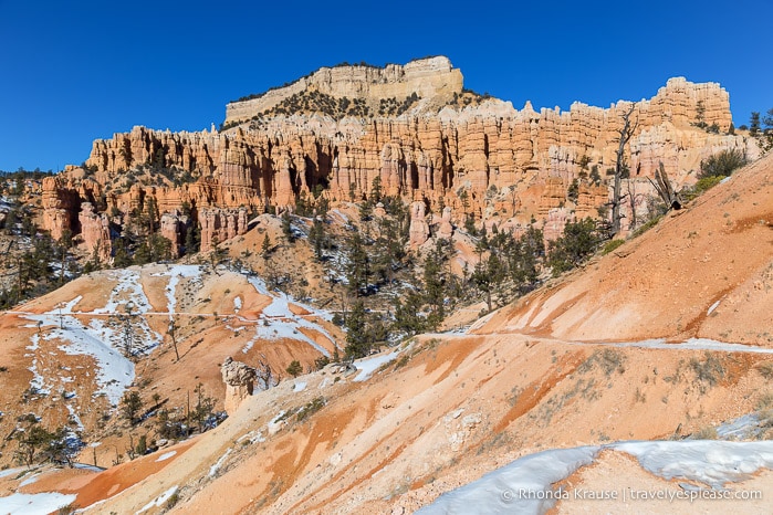
After a lunch break near the cat-shaped rock, we continued our hike around the north side of Boat Mesa climbing towards Fairyland Point. Much like before, the views continued to impress as we gazed across the hoodoo-filled amphitheatre.
After exiting the canyon at Fairyland Point, we continued along the Rim Trail back towards Sunrise Point.
On this last portion of Fairyland Loop it was so rewarding to be able to look down into the canyon where we had just hiked. I couldn’t see the exact trail we followed, since the area was so vast and packed with hoodoos, but I was able to pick out some of the notable landmarks we passed on our hike.
Spending the day hiking Fairyland Loop Trail and exploring a lesser-visited part of Bryce Amphitheatre was the perfect way to end our trip to Bryce Canyon. The intriguing geology made me wish we had time for more hikes in the park!
Final Thoughts About Our Fairyland Loop Hike
During our Southwest USA road trip, we wanted to admire the hoodoos of Bryce Canyon National Park and hiking Fairyland Loop was a fun and active way to do that.
We loved everything about this hike but what really made the experience special was having the trail almost all to ourselves. I’m not sure how busy this trail gets in the summer, but in January it was almost empty.
The scenery on Fairyland Loop Trail is stellar, even though we didn’t feel as “in” the hoodoos as we did on the Queen’s Garden Trail and Navajo Loop. I loved hiking past the long, narrow walls of rock and seeing erosion at work shaping them into hoodoos.
Of course, a highlight was seeing Tower Bridge, but the overall panoramic views of the landscape, both from inside the canyon and along the rim, were breathtaking.
Sure, the hike is on the long side, but with ever-changing scenery, a variety of shapes and colours, and views for the entirety of the trail, it never got boring. And while there are some parts that get the heart rate up, there was nothing too steep or grueling, especially if you hike the trail counterclockwise.
If you have more than one day in Bryce Canyon, we definitely recommend hiking Fairyland Loop!
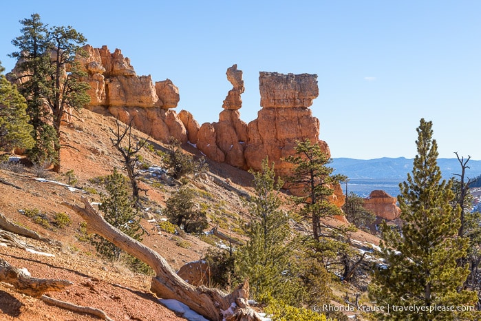
Pictures of Fairyland Loop Trail
Since I took so many photos of Fairyland Loop, here are a few more pictures for you to enjoy!
Tips for Hiking Fairyland Loop Trail
Trail Details: Here is some information about Fairyland Trail so you can prepare your hike.
- Type of Trail- Loop
- Distance- 12.9 kilometres/8 miles
- Elevation Gain- 523 m/1716 ft
- Difficulty- Moderate (some may find it strenuous because of its length)
- Length of Time– 4- 5 hours
- Trailhead- Fairyland Point (at the northern terminus of the Rim Trail) or near Sunrise Point (the middle of the Rim Trail, shuttle stop #13).
Getting to the Fairyland Trailheads: Fairyland Point is located before the park entrance/fee station, approximately 2 km/1 mi off the main road into the park. The access road to Fairyland Point is closed in the winter and is not served by the Bryce Amphitheatre Shuttle. If starting your hike from Fairyland Point, note that the parking lot is small so it’s recommended to get there early.
- The Fairyland hike can also be started just north of Sunrise Point. The closest parking to the trailhead is at the General Store on the Sunrise Point Access Road. Sunrise Point is on the park’s shuttle route (stop #13) which operates from April to mid-October. See the shuttle schedule here.
Best Time to Hike Fairyland Loop: The trail can be hiked year round but the best time is spring and fall when temperatures are cooler and fewer people are visiting the park. We hiked it in early January and found it to be pleasant.
- I would avoid this trail after a rainfall and during snowmelt because the dirt trail would be muddy.
Facilities: There is water and restrooms at the General Store near Sunrise Point, but no other facilities along the trail.
Safety: The main things you need to prepare for are sun exposure and a long hike time. Dehydration is a risk. This trail is not as busy as other hikes in Bryce Canyon National Park, so don’t assume there will be a lot of people around if you need help.
Gear/What to Bring: Bring plenty of water and sun protection, especially if hiking midday or in the warmer months. There’s not much shade on the trail.
- Comfortable and supportive hiking shoes/boots are recommended because of the length of the trail.
- Bring a snack to enjoy at one of the scenic spots on the trail.
Information was updated January 2025, but can change without notice. Please confirm directly with service providers.
Accommodations Near Bryce Canyon National Park
For your convenience, here is a list of hotels near Bryce Canyon National Park. Please consider booking your Bryce Canyon accommodations through the included link. It costs nothing extra and helps support this website. Thank you!
More Utah Hikes and Destinations
- How to Spend 3 Days in Zion National Park- Hikes, Walks and Scenic Drives
- Angels Landing Hike- What to Expect on Zion National Park’s Most Thrilling Trail
- Observation Point Trail- A Classic Hike in Zion National Park
- Hiking Watchman Trail in Zion National Park